
Explore Puerto Rico
Best Hiking Trails
Hiking in Puerto Rico is full of surprises, from unique wildlife and a wide variety of plants to breathtaking views you won’t find anywhere else.
PPuerto Rico is renowned for its beaches and historic Old San Juan, but what many don't realize is just how numerous the natural areas are for hiking, camping, and other outdoor adventures. On the Island's 3,500 square miles there are national and state forests, nature reserves, cave systems, and dozens of different ecosystems spanning coastal valleys, the karst region, wet and dry forest, and the United States' only tropical rainforest.
Hiking is a popular family activity in Puerto Rico so there are plenty of options for easy, relaxed hikes all around the island. Explore the salt flats and dry forest around Cabo Rojo. Stroll around the palm tree-lined lagoons of Humacao. Visit a "forest school" in the coffee-growing region of Adjuntas. Or make your way through subtropical forest to a hidden cave in Isabela.
Even for locals, this tropical rainforest contains certain magic with trails that range from short and sweet to challenging and adventurous. If you want to swim in some hidden natural pools, explore the La Coca trail, which starts behind the roadside waterfall. Or trek up El Toro trail to the highest peak of El Yunque, which is designated a cloud forest. There are a handful of options for tour companies that can lead you to some of the best locations within the park if you’re staying in San Juan but are looking to make a day trip to see more of the island.
Hiking Trails in Luquillo
El Yunque, Puerto Rico | QuedateEnPuertoRico.com
El Yunque National Forest
Luquillo
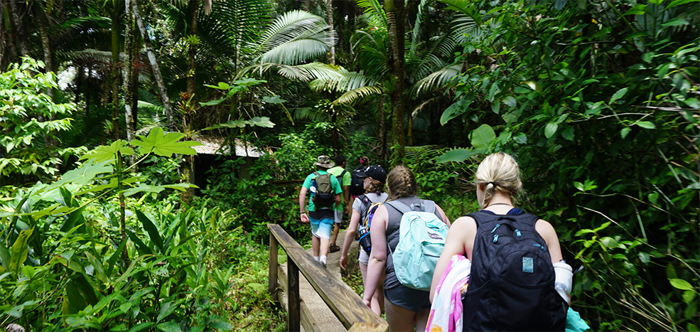
One of the most popular destinations in Puerto Rico for locals and visitors alike is El Yunque National Forest. This is the only tropical rainforest in the U.S. National Forest System and also one of the most biodiverse spots on the Island thanks to the park’s 240 different species of plants.
El Yunque National Forest
Whether you're looking to go birdwatching, swim in natural pools under waterfalls, or test your endurance on a challenging hike, El Yunque has trails for all types of adventures. Some of the trails that are currently open include La Coca Trail, Baño Grande, Angelito and Puente Roto, El Toro, Mt. Britton, and El Yunque Peak. There are also a handful of options for tour companies who can arrange half-day or full-day trips from San Juan to the park, if you’d prefer to have experts handle the planning and driving.
Caimitillo Trail
Luquillo
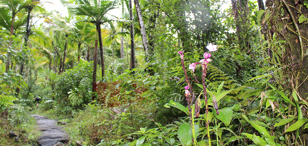
If you’re visiting El Yunque with the whole family, Caimitillo Trail is a perfect way to discover the rainforest on a relaxing walk that everyone can enjoy. It features rich foliage and opportunities to spot wildlife as you stroll along comfortable pathways, and you can find some great picnic spots to enjoy the atmosphere and rest. This short trail also leads to other, more challenging trails, so it’s a great starting point.
Caimitillo Trail
Along this trail you'll see giant tree ferns and sierra palms. This trail originates about 100 feet south (up) from the Sierra Palm Visitor Center on PR 191, km 12.0. Parking is available in a parking lot adjacent to the visitor center and at a designated area near the trailhead. At the trailhead, a series of concrete stairs, followed by wood supported steps cut into the rocky trail surface, lead upward to the Caimitillo picnic area. From the picnic area the trail continues past Giant Tree Ferns and Caimitillo Verde trees to the junction with the El Yunque trail.
El Toro Trail
Luquillo
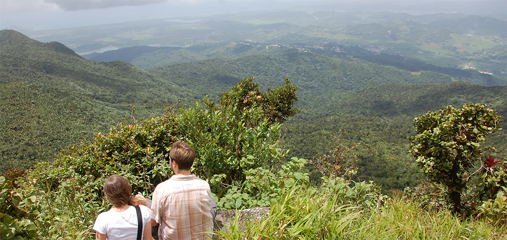
El Toro is still high on the list of best hikes in Puerto Rico. You don’t need to experience the trail’s entirety to achieve the feeling of standing atop one of the island’s tallest points, which is especially enjoyable on a cloudless day.
El Toro Wilderness Trail
When fully functional, the El Toro Trail covers roughly 12.5 miles (20 kilometers). At the time of this article’s publication, hikers are limited to a shorter, five-mile (eight-kilometer) loop that leads straight to the namesake peak. Attempting the summit will quickly reveal what kind of shape you’re in (or not), but catching your breath is all the sweeter when enjoying a breezy view of the surrounding Luquillo Mountains from 3,524 feet (1,074 meters).
The vegetation is different from what you might see higher up in the forest, and it includes breadfruit trees and philodendrons. The short trail ends at Las Damas pool in the Mameyes River, which has crystal-clear waters and a rope swing. For an extra special experience, enjoy the hike at night and discover the nocturnal wildlife on the tour below.
This is one of the best hikes in Puerto Rico and one that hiking enthusiasts should definitely add to their bucket list. It can get a bit muddy and has some unkempt areas, but for the most part, it’s a smooth trail with a steep climb. One of the best features is you can see the trees change as you reach the top, where only a “cloud forest” of stunted trees can grow. While this trail used to connect to the Trade Wind Trail, that section is currently closed to the public.
La Mina Trail
Luquillo
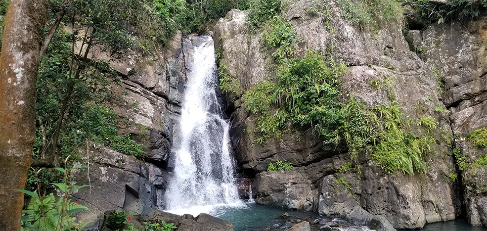
Located in El Yunque National Forest, the La Mina Trail is arguably the island’s busiest hiking trail, and braving the inevitable traffic will reward you with sweeping views of the area’s stunning landscapes.
La Mina Trail
The trail winds through the warm and dense El Yunque rainforest and mostly follows the winding La Mina River, even crossing over the gushing stream at times. The hike is short (around 45 minutes each way), but it has its difficult stretches before finishing off at the picturesque La Mina Waterfall. Like most busy attractions, the sooner in the day you can get yourself there, the better. Crowds will only grow as the day goes on, and if you’re interested in a chance at a peaceful swim, you’ll want to hit the trailhead early.
Mt Britton Trail
Luquillo
If you're short on time and want to feel like you've really “summited,” take the 0.8-mile (45-minute) climb up paved pathways, through the sierra palm forest into the cloud forest and the Mt Britton Tower. On a cloud-free day, the panoramic views from the stone lookout tower reach over the forest to the Atlantic and the Caribbean.
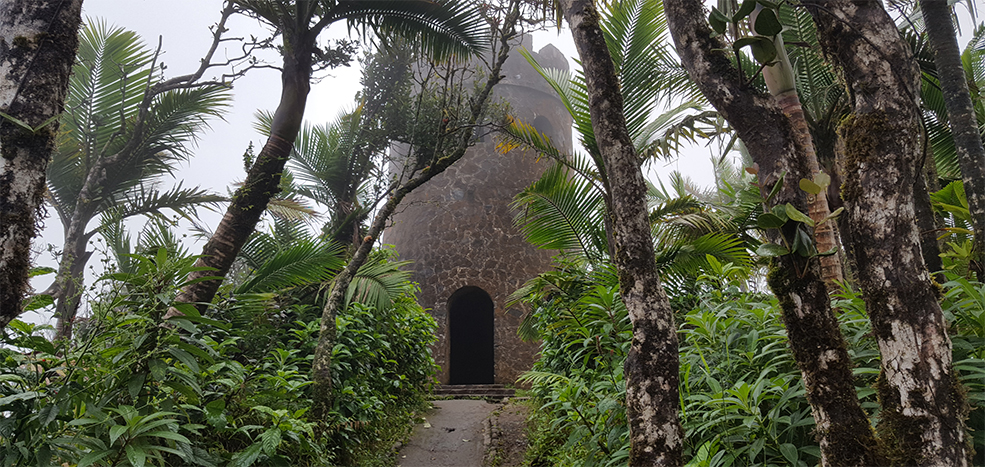
Mt Britton Trail
The trailhead veers off Hwy 191 for 0.3 miles at Km 13. Afterward, the more adventurous can connect to the El Yunque Trail via the 0.86-mile Mt Britton Spur. The tower was built in the 1930s by the Civilian Conservation Corps and named after the famous botanist Nathaniel Britton, who identified several plant and tree species in the region in the 1920s.
Hiking Trails in Cabo Rojo
Cabo Rojo National Wildlife Refuge and Salt Flats
Cabo Rojo
The Cabo Rojo National Wildlife Refuge is managed by US Fish and Wildlife Service and has a variety of hiking and biking trails.
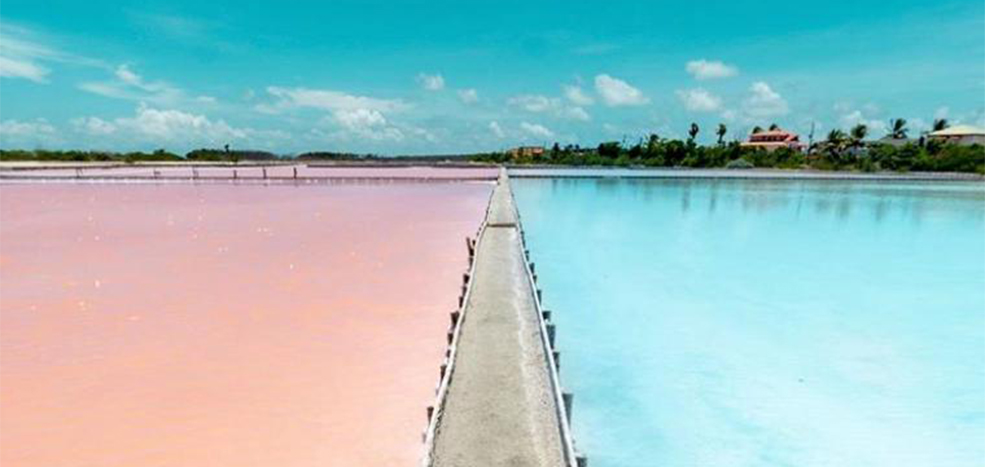
Cabo Rojo National Wildlife Refuge and Salt Flats
These are mostly flat, surrounded by a wide variety of dry forest plant life and native birds, with observation towers along the route. There are also trails around the bright pink salt flats, which create a stunning and surreal landscape. If you want to challenge yourself, follow the trails all the way to the jagged cliffs of Los Morrillos Lighthouse and beautiful Playuela beach.
To explore a truly surreal landscape, visit the salt flats of Cabo Rojo. The visitor's center is in front of an observation tower, from which you'll enjoy panoramic views of the bright pink lakes where salt is harvested. From there, you can choose several different trails to explore, including some that extend to the Los Morrillos Lighthouse, which is atop rugged cliffs overlooking the Caribbean Sea. Or you can take a detour to one of Cabo Rojo's famous beaches. Bring plenty of water (you'll be walking through a dry forest), sunscreen, appropriate clothes, and sturdy hiking boots.
Los Morrillos Lighthouse
Cabo Rojo
From this smartly remodeled lighthouse at the bone-rattling end of Hwy 301, there's not much further you can go: you're as south as it gets in Puerto Rico.
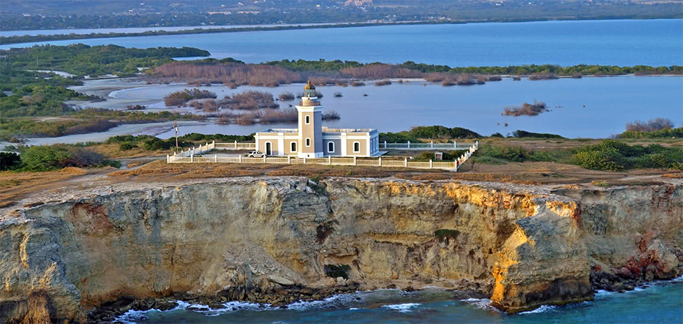
Los Morrillos Lighthouse
The Los Morrillos Lighthouse stands sentinel on the headland of Punta Jagüey, with some dramatic cliff formations right beyond the outer walls. An observation deck overlooks the surreal turquoise of the waters lapping Playa Santa and the expanse of the Caribbean behind. If a volunteer is on hand at the lighthouse, they might offer a casual history of the Refugio Nacional Cabo Rojo area (largely revolving around the salt panned nearby). The final stretch of gravel road is not passable for cars but a 10-minute walk from the parking lot will have you at the door.
Hiking Trails in Humacao
Humacao Nature Reserve
Humacao
The Humacao Natural Reserve is located on Puerto Rico's southeast coast, between the towns of Humacao and Naguabo. This natural reserve was established in 1986 and it's managed by Puerto Rico's Department of Natural Resources. There is kayaking and bike rental on site. Within the reserve, you'll find multiple trails for hiking and biking, stretches of beaches, fishing spots, and more.
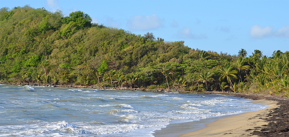
Humacao Nature Reserve
The recreational area of the Humacao Nature Reserve, also known as the Punta Santiago Natural Reserve, has six acres of flat, well-marked trails winding their way through a palm tree forest, mangroves, around lagoons, and onto the beach. Off the main trail there is one hill with a short steep climb called El Morrillo which offers a stunning view of the coast. At the reserve there are gazebos for picnics, bathroom facilities, free parking, you can go fishing, and you can rent bikes, paddleboards, or kayaks.
Hiking Trails in Manatí
Hacienda La Esperanza Nature Reserve
Manatí
This extremely varied natural reserve has half a dozen different ecosystems within it: wetland, grassland, karst hills, mangroves, an estuary, and beaches. The property at Hacienda La Esperanza, which includes a historic and very well-maintained sugar mill, is managed by conservation organization Para La Naturaleza. Their visitor's center is a manor house which is part museum and part education center. To visit the hacienda, reserve a tour with Para La Naturaleza, most of which involve a guided hike through the property.
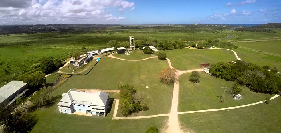
Hacienda La Esperanza Nature Reserve
If you'd rather do your own hike, follow the road where the visitors center is located to the end. There will be a gate and a trailhead. You can park on the side of the street (at your own risk!) and hike the trail all the way to Esperanza Beach, a lovely secluded beach with shallow waters and large volcanic rock formations. If you continue down that trail, you'll reach a second beach with black sand. These hikes are easy and the trails are well-marked, just be sure to bring water and food, sunscreen, hats, and a bathing suit.
Hiking Trails in Isabela
Guajataca State Forest and Tunnel
Isabela
The Guajataca State Forest is over 2,000 acres of subtropical wet forest, located in the Karst region of Puerto Rico.
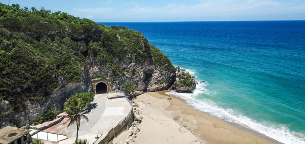
Guajataca State Forest and Tunnel
There are two well-known trails leading from the parking area and ranger station at KM 9 on Route 446 in Isabela. One is the Interpretative Trail, which is a two-mile loop, with a side trail leading to an observation tower. The second trail leads to the Cueva del Viento (Cave of the Wind), a limestone cave with beautiful stalactite and stalagmite formations and many, many bats. There are steps leading into the cave but no illumination or guardrails, so bring sturdy footwear and powerful flashlights if you want to explore it. Also, bring plenty of water and snacks for the hike.
For a beautiful, easy coastal hike visit the nearby Guajataca Tunnel, an old railway tunnel carved into the side of the mountain. There is a park built around it, with a trail that follows a former railroad route along the coast through the tunnel and several rock cuts before arriving at Guajataca beach.
Interpretative Trail
Isabela
The Interpretative Trail is one of two main trails found in the Guajataca Forest, a small, dry subtropical forest in the island’s northwest region. As many people travel to this area for its nearby beaches and coastline, it’s definitely a worthy stop to make for a quick adventure.
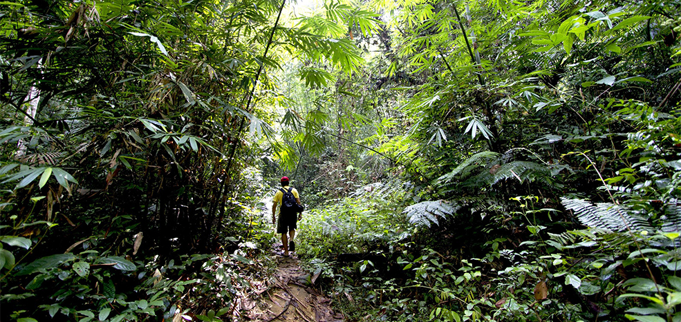
Interpretative Trail
You can find the trailhead just a few feet from the visitor’s center and, while traversing the two-mile (3.2-kilometer) trail, enjoy the serenity of the forest — full of birds and butterflies — that’s unlike any other protected area in Puerto Rico. This trail is a circle — so it starts at the Information Center and ends just a few hundred feet up the road at the picnic/camping area. According to the information sheet that the DRNA gives out, this trail it is 3.2 KM long (about 2 miles). However, according to our GPS, it was actually only about 1.3 miles.
Hiking Trails in Bayamón
Parque Julio Enrique Monagas
Bayamón
The Julio Enrique Monagas National Park, located in Bayamón, used to be an ammunition and weapons warehouse for WWII, but now serves a more peaceful cause. Today, most of the visitors are mountain bikers, as it is one of the few tracks in the metro area. If you are going to the park for the first time, to practice this sport, we recommend seeking advice with the mountain bikers on guidance for the trail you should choose depending on your experience. Some of these trails are dangerous if you do not have adequate experience.
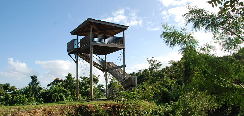
Parque Julio Enrique Monagas
Located just a few miles outside of San Juan, Parque Julio Enrique Monagas is a 200-acre urban park with wide easy trails that cross dense forests dotted with old abandoned army bunkers (next door is army base Fort Buchannan). You’ll also find single-track mountain biking trails that range from easy to difficult (these can get very muddy if it's been raining). From the parking lot there is a trail up to an observation tower overlooking the mountainous terrain near the metro area. The park has parking and bathroom facilities. Along with hiking, the park is popular among rock climbers, birdwatchers, mountain bikers, and has horseback riding facilities.
Hiking Trails in Adjuntas
Bosque Escuela La Olimpia
Adjuntas
This “Forest School” is located on the very same land that Casa Pueblo was formed to protect. Following a grueling fifteen year effort, the mining concerns were defeated, and the land was placed under the protection of the Bosque de Pueblo. In 2003 Casa Pueblo was able to purchase 150 acres of this land. The area is now used in support of the organization’s founding equation, “science+culture+community=change”. Bosque Escuela is part of an international group of educational spaces in which the floor is made of fallen leaves and the walls of flowers and trees. This school is used to teach children and adults the important role the forest plays within the island’s ecosystems.
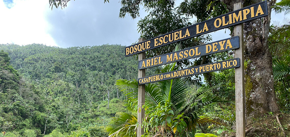
Bosque Escuela La Olimpia
Casa Pueblo, a community-based nonprofit organization in the mountainous town of Adjuntas, turned 150 acres of subtropical wet forest into an outdoor school which they named Bosque Escuela La Olimpia "Ariel Massol Deyá" (in English, Forest School La Olimpia). Their mission is to conserve the land and also "humanize" nature by bringing educational experiences into the forest. The trail begins with several outdoor "classrooms" and leads to a river with waterfalls and areas for swimming. To visit to the forest school, coordinate with Casa Pueblo beforehand 787-829-4842. There is also a tour company called Puerto Rico al Sur which organizes excursions and interpretative hikes to different places in the southern region of Puerto Rico, including Bosque Escuela La Olimpia.
El Ataud
Adjuntas
Several waterfalls cascade into deep pools in the jungle near Adjuntas, which makes for the perfect setting to cliffjump, swim, and escape the heat of the day.
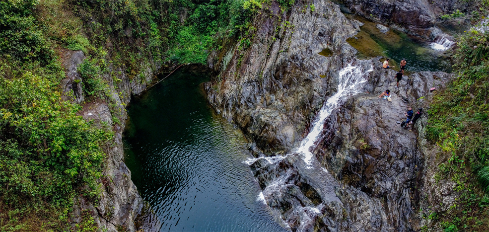
El Ataud
If you're heading out of Adjuntas, take Route 10 N and make a right onto Route 123 N, follow that until you can make a left onto Route 123 S. Go South on Route 123, then turn right onto Route 522 (follow the signs for Parador Sotomeyer). When you get there, go to the left. The road will make several 'V's" but just stay on the main road. At one of the V’s, you’ll notice a bridge to your left. Use that bridge to cross the river and then continue up the road to the right. In about 5 minutes you will come to a place where there are little lots on the side of the road to park. There is an unmarked trail that leads down to the falls. The trail will lead you to the top of the falls, you have to do a bit of rock scrambling to get down to the bottom / swimming hole. There are several places to cliff jump on the other side of the pool.
Hiking Trails in Salinas
Arbol Solitario
Salinas
Stunning 360 degree views of the surrounding mountain ranges, towns and the Caribbean Sea await you just a short hike from the highway. About halfway between Cayey and Ponce, you will see a runaway truck ramp on the north side of the highway. The best place to park for this hike is just right on the shoulder of the road (Make sure you aren't blocking the truck ramp or you risk getting a ticket). Keep in mind if you are coming from the Ponce direction, you need to flip a quick U-turn shortly after you see the ramp to get going in the right direction. The trail begins right at the top of the ramp.
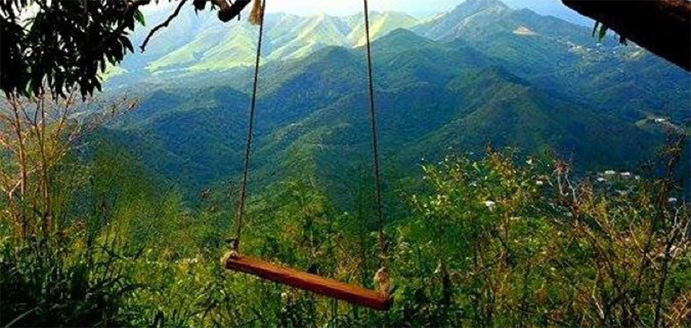
Arbol Solitario
There are two different paths so make sure you take the one going left. Its a straightforward hike from this point, winding up through the jungle until it opens up into waist-high grass. The trail is a steep dirt path and ascends almost 600 feet in an extremely short distance. It can get extremely slippery and muddy after it rains so try to plan it when the weather is dry. A good hiking stick is recommended. Stunning panoramic views await you at the top. The mango tree that this place gets its name from sits just below the summit on the northern slope. It can get extremely busy during the day so I recommend going in the morning to beat the crowds and also get a stunning view of the sunrise.
Hiking Trails in Vieques
Cayo de Tierra
Vieques
The island municipality Vieques has several cays around it, many of which are only accessible via boat or kayaking. The exception is Cayo de Tierra (Earth Cay), located between the town of Esperanza and Playa Sun Bay, which is connected to Vieques by an isthmus of sand and rock. You can hike the isthmus to the cay where the trail leads up to the a lagoon and a small hill with a view of the cliffs and beaches of the main island.
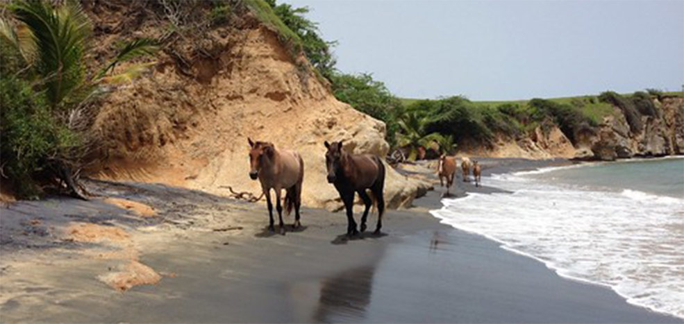
Cayo de Tierra
You don’t have to walk far to get to this trail because it’s right off the beach in Esperanza. As you look to the water from Esperanza you’ll see two cays, Cayo de Tierra is the one attached to the island and the sand / dirt path divides the beaches of Esperanza and Sun Bay. As you walk towards the Cayo de Tierra, steer to the left side of the island. Bring your camera you will have many photo opportunities. You can hike to the very top of Cayo de Tierra, you may want to sit down at the edge of the cliff to enjoy the breathtaking views of the blue waters of Vieques.
Hiking Trails in Fajardo
La Zanja
Fajardo
In Spanish, the name of this cave means "The Trench." La Zanja is a unique natural swimming pool protected from the Atlantic surge. Popular among locals, this trail is a bit of a trek. Begin at Seven Seas beach and walk along the beach until you reach the coastal cliffs. Eventually, you will come to a volcanic rock projection that you ascend before descending into the cave. Wear water shoes or hiking boots if you don't mind getting wet, and make sure to bring water, food, and wear a bathing suit under your clothes.
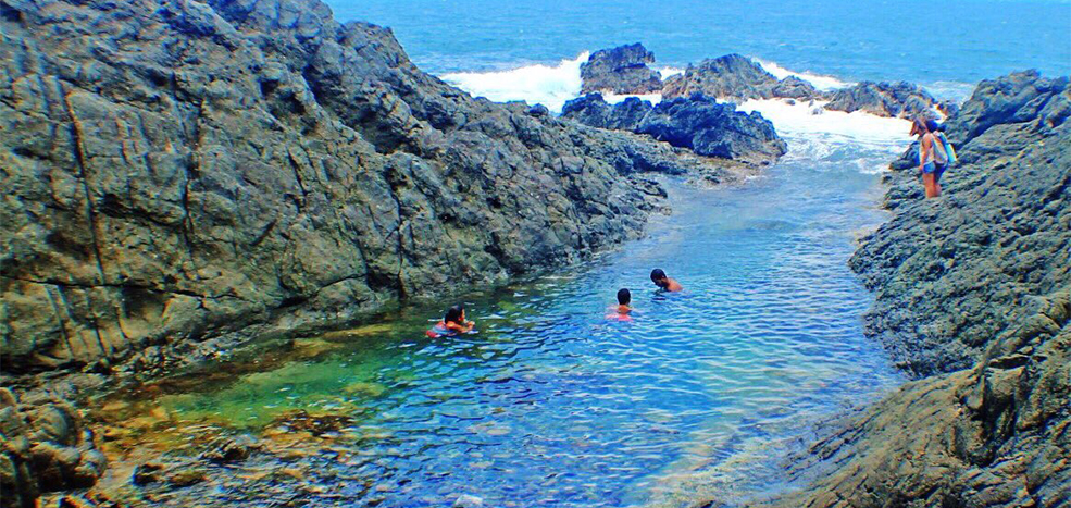
La Zanja
La Zanja is located in the Cabezas de San Juan Natural Reserve, which is managed by Para La Naturaleza. Visit their website for more hiking options in the reserve. Sierra Club of Puerto Rico periodically organizes a challenging hike around the Cabezas de San Juan Reserve called Escarpados y Farallones Opens in new window, which includes a dip in La Zanja.
Hiking Trails in Aguadilla
Survival Beach
Aguadilla
To reach Survival Beach in Aguadilla, you begin at Surfers' Beach, then follow a trail that is difficult yet short, since it requires climbing over large rocks and along sometimes steep coastal embankments.
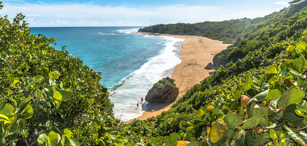
Survival Beach
Depending on your fitness level, the hike takes about 30 to 45 minutes, and in the end, you reach a secret beach scattered with giant boulders that create elaborate rock sculptures and sea caves. The waves can be rough, and the undertow dangerous, depending on the time of year (things are calmer during the summer and more severe during the winter), so it's best to enjoy the scenery from the shore. Also, be sure to wear sturdy shoes and bring water and sunscreen.
Hiking Trails in Guánica
Fuerte Caprón
Guánica
This is a relatively short trail within the Guánica Dry Forest Reserve (about 5 kilometers each way), but the heat and some short uphills make it challenging.
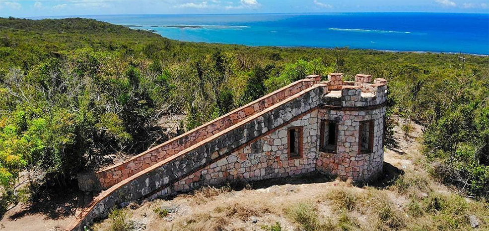
Fuerte Caprón
The effort is worth the payoff as the trail leads you to a hidden stone fort and breathtaking views of the Bay of Guánica: a picturesque vision composed of bright blue cays framed by rolling hills. Bring plenty of water and snacks, apply sunscreen liberally, and try to start your hike early to avoid the hotter parts of the day.
Ballena Trail – Guánica Dry Forest
Guánica
Located on the south side of the island, the Guánica Dry Forest has an arid climate with desert-like conditions. Its features are almost the complete opposite of El Yunque — you can find cacti and other similar plants in this subtropical dry forest.
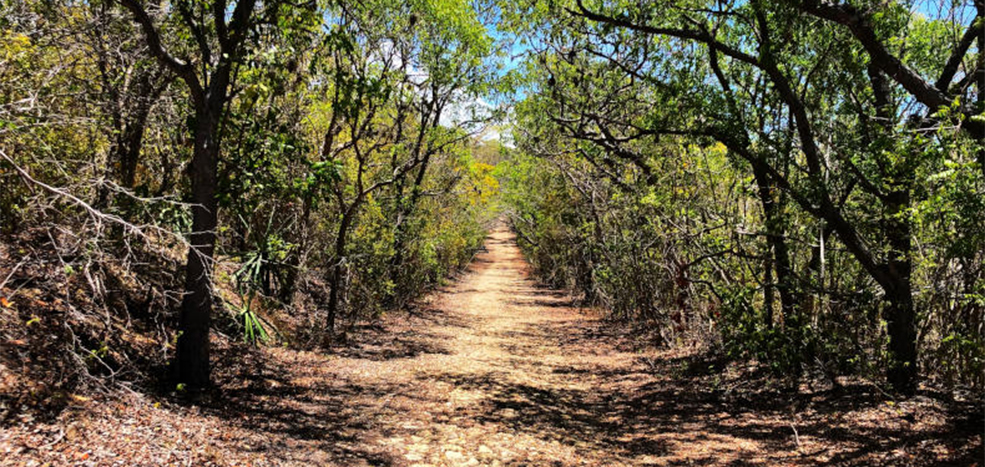
Ballena Trail – Guánica Dry Forest
Ballena Trail leads to Ballena Beach, known for its mangrove area, and you can also find limestone caves to explore. This slightly uphill hike is not technically challenging, but the heat can make the conditions difficult. It’s best to visit during the winter months and avoid the hottest times of the day.
Vereda Meseta
Guánica
This beautiful trail traces the coastal part of the Bosque Estatal de Guánica, and is one of the reserve's few routes that you pick up by following Hwy 333 to its termination at the Bahía de la Ballena.
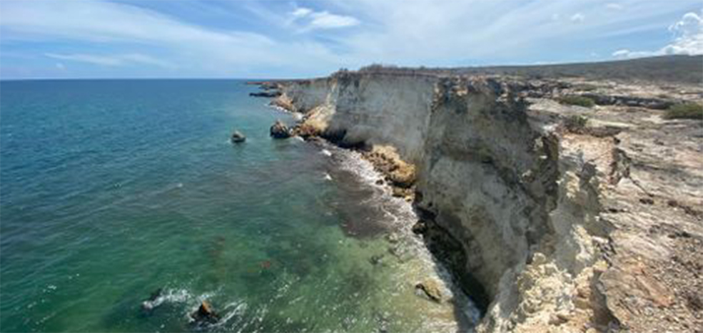
Vereda Meseta
The Meseta Trail, which is about 4 miles round trip, begins at the end of Road 333, at the gate for Tamarindo Beach. The trail head is near the gate (where the road stops), not inside the beach parking area. The Meseta Trail heads east along the southern coast. The trail starts out wide and gradually gets smaller and smaller until it seems to be only a few inches wide. The first ½ mile is the commonly used hiking trail. Beyond that it is mainly a mountain bike trail. Motorized vehicles are not allowed on the trail, but this trail is regularly used by mountain bikers. There are a whole load of mountain bike trails in this south/west area!
Hiking Trails in Aibonito
Cañón San Cristóbal
Aibonito
A gorgeous, challenging hike to Puerto Rico's largest waterfall. The hike from one end of Cañon San Cristobal to the other is arguably the most epic in Puerto Rico. Descend a thousand feet into a turquoise swimming hole, climb up a waterfall and find yourself in a valley so perfect it doesn't seem real. Climb up another waterfall, hike about a mile and you'll come to 'La Niebla': the largest waterfall on the island, 300 feet of water cascading down the side of the canyon. The hike is about 4 miles end to end but will take a good 4-5 hours thanks to the difficulty of parts of the climb.
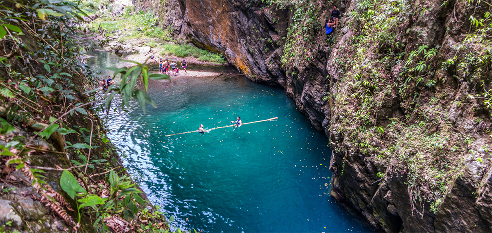
Cañón San Cristóbal
Deep in the central mountain range of Puerto Rico is the Cañón San Cristóbal, a literal crack in the Earth caused by tectonic movements. It's 5.6 miles long, and at the bottom, there is a flowing river as well as swimming holes and waterfalls. The trail there requires hikers to be in excellent physical condition, and if you want to reach the bottom, there is a fair amount of climbing and a spot or two that may require rappelling. For this adventure, it's best to do the hike with a certified company such as Go Hiking Puerto Rico or Para La Naturaleza.
Hiking Trails in Patillas
Charco Azul Trail – Carite State Forest
Caguas, Cayey, Guayama, Patillas and San Lorenzo
Carite State Forest (Spanish: Bosque Estatal de Carite) is a state forest and nature reserve located in the Sierra de Cayey mountain range in southeastern Puerto Rico. The forest extends over approximately 6,500 acres and is located in the municipalities of Caguas, Cayey, Guayama, Patillas and San Lorenzo. The forest is located along the Ruta Panorámica (officially the Luis Muñoz Marín Scenic Route), which offers access to the forest.
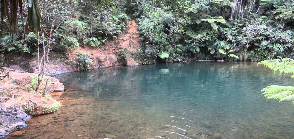
Charco Azul Trail – Carite State Forest
The trail is paved all the way, featuring small bridges that cross over rivers. Charco Azul is one of the main highlights of the state forest. This is a clear, blue-colored natural pool formed by the Charco Azul river falls, which flow into the Patillas River. The stunning Charco Azul is a beautiful blue lake where you can take a refreshing swim at the end of your hike. The area, located along PR-184, offers sites for picnics, camping and showers and restrooms for people who wish to swim in it.
Hiking Trails in Arecibo
Cambalache State Forest
Arecibo
The Cambalache State Forest is located in the town of Arecibo and can be easily reached by taking Highway 22, which crosses through the northern side of the island. The forest has various hiking trails, gazebos, camping facilities, and on-site parking. The park is especially popular with mountain biking enthusiasts.
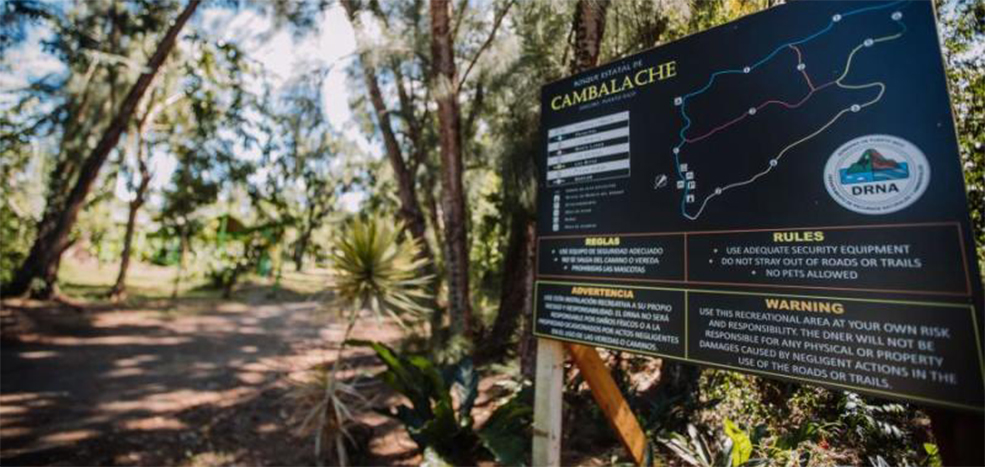
Cambalache State Forest
Cambalache State Forest is the perfect setting for a leisurely hike in nature (mountain bikes also welcome), or enjoy birdwatching and camping. The facilities are easily accessible and include parking, bathrooms, picnic tables and gazebos, and there's even an ornithological center that opens on weekends. During your hike you can spot more than 150 types of trees and shrubs, of which 15 are endemic and 10 are rare or endangered. Birding is also popular here since you can spot 45 species of birds, including 12 of the 17 that are endemic to Puerto Rico.
La Cueva del Indio (Indian Cave)
Arecibo
La Cueva del Indio is one of the most beautiful places on the island of Puerto Rico – there's nothing quite like witnessing the majesty of a sunset on the cliff, and yet it's still incredible all day long. It takes about five minutes to walk out onto the cliffs. Two movies were filmed on these cliffs, which you can learn about at the restaurant nearby.
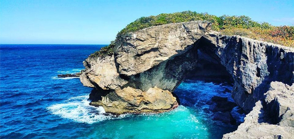
La Cueva del Indio (Indian Cave)
The cave is up to the left. You will have to climb down a ladder to find the cave drawings. These drawings are incredible, and tell a story about the original inhabitants of the island. Down in the cave, water from the tide flows in from underneath, and when the waves are big, water flows through an opening facing the ocean. The pink rock and blue water contrast beautifully. There is also a beautiful, hidden beach just to the east, which will require hiking through some foliage and continuing along the cliff for a few minutes.
Cueva Ventana (The Window Cave)
Arecibo
Easy 15 minute walk to the cave. Incredible view. Learn cultural and ecological history. Travel through an exciting cave to reach the window view. Wildlife is very common.
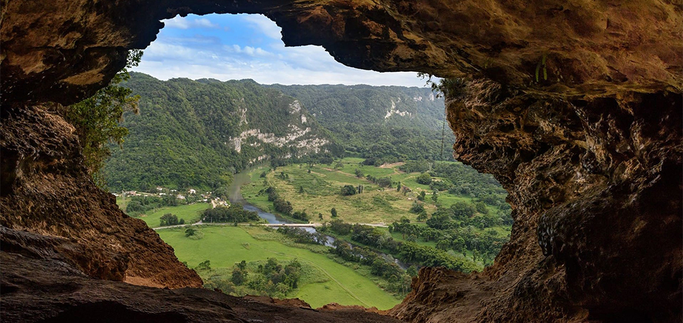
Cueva Ventana (The Window Cave)
Take a short and easy guided hike up to and through the cave to this amazing view of the surrounding landscape and the Rio Grande de Puerto Rico, the river that runs below the cave. It is a 15 minute walk to reach the cave, then you will have another 30 minutes to explore the interior. The guide will teach you about the history and ecology of Puerto Rico, and a lot about the area.
After reaching this view you can take the same path back, or you can travel down through to another cave. The time it takes to return is about the same, but you get the experience of going in through one part of the cave and coming out the other. The cave has lots of fruit bats, and the guides are careful not to bother or disturb them while you are moving through. They will provide lamps, as well.
Hiking Trails in Rio Grande
Juan Diego Falls
Rio Grande
An easily missed miniature trail leads to a pair of gorgeous, secluded waterfalls.
Juan Diego Falls are a pair of waterfalls that can be accessed by an incredibly short and ignored trail when passing through El Yunque. When driving up the mountain (heading southwest on 191) the trail entrance can be found behind a road barrier on the right hand side of the road at approximately KM 9.8. This is at a corner between Yokahú Tower and Big Tree Trail's parking areas. There are marked parking areas along the side of the road near this entrance, so park there if you can. You'll know when you've found the trailhead when you spot a trashcan and a small safety sign just off the road and behind a barrier.
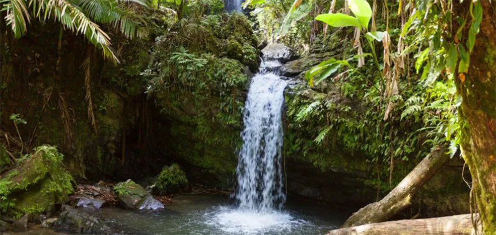
Juan Diego Falls
Follow the steep path up and along the right of a stream and you'll quickly come across the first of the two falls. This one should be about 2 meters tall and makes for a nice photo opportunity. The larger and more impressive waterfall can be seen behind and above this one.
Although the distance to the larger falls and pool is small, to get there you will have to be a bit adventurous and quite careful as there is not a blazed and easy path. I took the muddy footpath on the right and followed it as it made a sharp and steep left. If you continue to climb up about 40 feet of steep and muddy terrain you will have to veer to the left and take a very narrow and treacherous footpath to the falls. While short, this part of the hike may not be safe for beginners or kids as the trail is very muddy, narrow, and has a dangerous-looking drop-off on the left.
Once you've navigated the "cliff" there be sure to get soaked in the waterfall.
Hiking Trails in Jayuya
Cerro de Punta
Jayuya
Cerro Punta in Jayuya is the island's highest peak at an elevation of 1,338 meters above sea level. Get panoramic views of the island by either driving or hiking up the mountain. If you're driving up, it's recommended to do so in a four-wheel drive. The hike up the road that leads to the peak is about 30 minutes long.
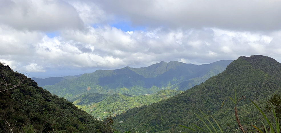
Cerro de Punta
To reach the mountain’s summit, it’s best to start from the trailhead near Hacienda Gripiñas, an old coffee-plantation-turned-inn. The hike is only a five-mile (eight-kilometer) round-trip and, at such towering altitude, travels through a unique environment called a cloud forest. If you’re planning on tackling this hike, cross your fingers for a sunny day, as it’s possible to see the entire island from the top, with views spanning up to 75 miles (120 kilometers) in some directions!
Hiking Trails in Culebra Island
Culebra Island
Culebra
Top beaches in the world. Snorkeling with turtles, sting rays and coral reefs. Beautiful hidden Caribbean paradise. Stay as long as you'd like!
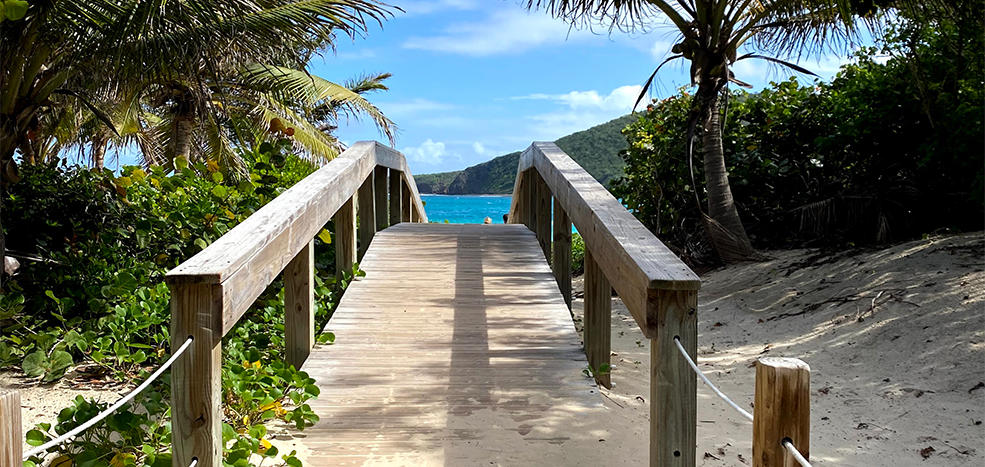
Culebra Island
At Flamenco Beach, which is always ranked among the top 5 beaches in the world, the water is incredibly blue, and the sand is white and soft. The contrast of colors with the green island behind it is indescribably beautiful. Flamenco is usually pretty busy with people because it's so popular, and there are a couple places to eat close by.
Just to southwest of Flamenco, you can take a road out to Tamarindo Beach, where you can swim and snorkel with turtles, sting rays, and all kinds of fish. There is also a beautiful coral reef right there. You can rent snorkeling gear for around $10 on site, but you can also bring your own.
If you have a rented Jeep (see below) you can explore the whole island and head over to Zoni Beach, which has a lot less people and is still extremely beautiful. They will give you a map of the island that will help you find more places to explore!
Whether you're there for a day or a week, this beautiful island paradise will treat you so well, and you'll be able to relax like never before. Have fun exploring!
Getting there: The island of Culebra is just east of Puerto Rico, and it takes about an hour and a half on a ferry to get there. You can also fly out of the airport, it's just not nearly as cheap as the ferry. The ferry takes off from Fajardo, Puerto Rico, which is about an hour and a half east of San Juan. A roundtrip ticket costs $4 and must be purchased in Fajardo.
Once on the island you can take a shuttle bus out to Flamenco Beach. You can also rent a Jeep for the day to explore the entire island - it costs a little bit more than the shuttle but is well worth it! There are lots of people offering Jeep rentals on the island, so that won't be difficult to find.
Hiking Trails in Villalba
Toro Negro State Forest
Jayuya/Ponce/Villalba/Orocovis/Ciales/Juana Díaz
As you cruise the winding PR-563 through the Ala de la Piedra borough, you'll find on the side of the road the main entrance to Bosque Toro Negro, a vast forest with around 18 km of trails where you can hike, take a plunge into its cold, pristine ponds and set up your camping tent for a relaxing weekend in the woods. There's also an observation tower atop the Cerro Doña Juan, which is Orocovis' highest point, and which you can climb to experience one of the best views Puerto Rico has to offer. Moreover, the camping site in Barrio Ala de la Piedra is a great place to stay in Orocovis during the weekend.
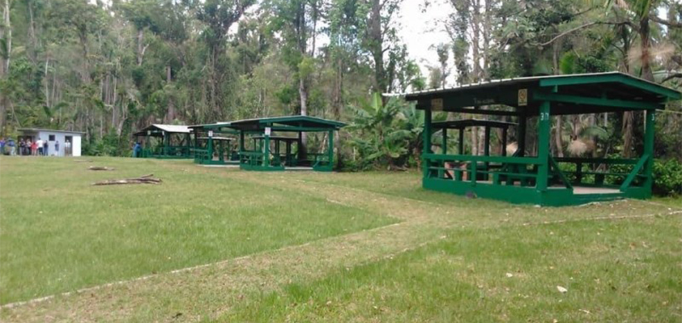
Toro Negro State Forest
The nearly 7,000 acres of Toro Negro State Forest is spread over six different municipalities and includes four types of forest (tabonuco, palm, Micropholis Buchenavia, and a cloud forest), the three highest peaks of the Island (Cerro de Punta, Cerro Jayuya, and Cerro Rosa), a lake, two natural swimming pools, nine rivers, and numerous waterfalls.
To hike and camp there, visit the ranger station on Route 143 KM 32.4 in Villalba. Most of the trailheads are concentrated in this area, and the most popular (and currently open) are El Bolo, which leads to a stone tower on the top of a mountain, and Charco La Confesora, which has a trailhead at the Toro Negro camping grounds.
You May Also Like
-

06 Jul 2022
Puerto Rico Videos -

07 May 2022
Best Family Friendly Activities -

30 Apr 2022
Best Hiking Trails in Puerto Rico -

29 Apr 2022
Food Trails and Culinary Adventures -

29 Apr 2022
Puerto Rican Cocktails & Drinks -

28 Apr 2022
Landmarks and Iconic Places -

27 Apr 2022
Puerto Rican Traditional Dishes -

26 Apr 2022
Events and Festivals in Puerto Rico -

25 Apr 2022
The Musical Sounds of the Island -

25 Apr 2022
Art Museums in Puerto Rico -

24 Apr 2022
Puerto Rico Natural Wonders -

17 Apr 2022
Best Beaches in Puerto Rico -

17 Apr 2022
The Best Spots for Watersports -

10 Feb 2022
Puerto Rico – Island of Enchantment -

01 May 2018
Where to Surf in Puerto Rico

